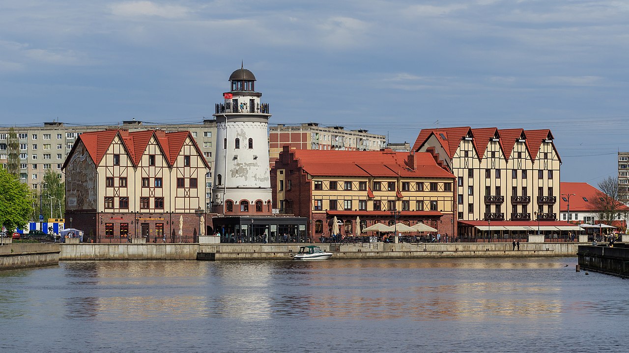
Kaliningrad is a Russian region on the Baltic Sea that has been physically cut off from the rest of Russia since the Soviet Union's 1991 collapse, bordered only by EU and NATO members Poland and Lithuania. Once the German city of Königsberg, it became Soviet territory after 1945 and today hosts Russia's Baltic Fleet headquarters and missile units, making it central to Russia-NATO tensions.
Where Kaliningrad is and why it is isolated
Kaliningrad is both a city and the capital of Kaliningrad Oblast, a Russian federal region that sits on the Baltic Sea at the mouth of the Pregolya River. The oblast is an exclave of Russia, located 663 kilometres west of the rest of the country and wedged between Poland and Lithuania, according to the English-language Wikipedia entry on the city.
The city itself covers 223 square kilometres and has a humid continental to oceanic climate, with average winter temperatures around -1.5°C and summers around 18.1°C, per the same source. Kaliningrad is described as the only ice-free Russian port on the Baltic Sea, a feature that underpins its strategic value to Moscow.
From Königsberg to Kaliningrad: how the territory became Russian
The city was founded on 1 September 1255 by the Teutonic Knights as Königsberg, on the site of an earlier Old Prussian settlement, and went on to serve as capital of the Teutonic State, the Duchy of Prussia and later East Prussia, English Wikipedia states. The city suffered heavy damage from Allied bombing in 1944 and fell to Soviet forces after a siege in spring 1945, according to the same source.
Under the Potsdam Agreement of 1 August 1945, the city passed to Soviet administration pending a final territorial settlement. Soviet authorities renamed it Kaliningrad in July 1946 after Soviet leader Mikhail Kalinin. Between 1947 and 1948, an estimated 100,000 Germans were expelled, while around 400,000 Soviet civilians — mostly Russians, along with Ukrainians and Belarusians — were resettled there by 1948, per English Wikipedia. The territory's status was only formally settled under international law on 12 September 1990, with the Treaty on the Final Settlement with Respect to Germany.
Kaliningrad's population through the 1945 transition
Period
Population
Source note
Pre-war Königsberg
approx. 370,000
English Wikipedia
1956 (after resettlement)
188,000
English Wikipedia
2010 Census
431,402
English Wikipedia
2021 estimate
490,449
English Wikipedia
Guide: understanding Kaliningrad's exclave status today
Start with the 1991 break: when the Soviet Union dissolved, Kaliningrad was left separated from the rest of Russia by newly independent Lithuania and Belarus, English Wikipedia notes.
Add the 2004 shift: Poland and Lithuania joined both NATO and the European Union that year, meaning every land and most civilian routes between Kaliningrad and mainland Russia now cross NATO/EU territory.
Note the travel workaround: residents and visitors use special 'Facilitated Transit Documents' to move between the exclave and mainland Russia across Lithuania, per English Wikipedia.
Factor in the February 2025 energy break: Estonia, Latvia and Lithuania disconnected from Russia's shared power grid on 9 February 2025 and joined the European grid instead, according to ABC News. This left Kaliningrad to run its power system independently of mainland Russia.
Weigh the cost: English Wikipedia puts the new infrastructure investment linked to this disconnection at roughly $1 billion, while ABC News reports the three Baltic states spent about €1.6 billion since 2018 preparing their own grids for the switch — the two figures reflect different scopes of spending.
We have removed any theoretical possibility of Russia using energy (grid) control as a weapon.
— Žygimantas Vaičiūnas, Lithuanian Energy Minister, quoted by ABC News
Military and strategic significance
Kaliningrad hosts the headquarters of Russia's Baltic Fleet and is counted among the country's largest industrial centres, English Wikipedia states. A Voronezh-class radar commissioned there in late 2011 is designed to monitor missile launches within a 6,000-kilometre range, and the exclave was briefly considered for nuclear missile deployment between 2007 and 2009.
GIS Reports Online, an analysis published by geopolitical researcher Stefan Hedlund, describes Kaliningrad functioning as an 'anti-access/area denial' zone, equipped with Iskander ballistic missiles capable of carrying nuclear warheads, S-400 air defence systems and Bastion coastal defence platforms, alongside an upgraded Baltic Fleet based at Baltiysk.
The same analysis highlights the Suwałki Gap, a roughly 70-kilometre corridor between Kaliningrad and Belarus that forms the only land connection between the Baltic NATO members (Estonia, Latvia, Lithuania) and the rest of the alliance. GIS Reports Online notes that any NATO ground reinforcement through this corridor would be exposed to fire from both the Kaliningrad and Belarusian sides, while a naval approach would have to pass Kaliningrad's missile batteries.
GIS Reports Online also points out that Finland and Sweden's accession to NATO changed the surrounding military balance by exposing Russian positions near Kaliningrad to potential missile and artillery reach from new NATO territory.
Questions
What is Kaliningrad?
Kaliningrad is a city and Russian federal region (oblast) on the Baltic Sea, built on the site of the former German city of Königsberg. It functions as a Russian exclave, separated from the rest of Russia by Lithuania and Belarus, according to English Wikipedia.
Why is Kaliningrad called an exclave?
It became physically cut off from mainland Russia after the Soviet Union dissolved in 1991, since the newly independent states of Lithuania and Belarus lie between it and the rest of Russia, per English Wikipedia.
What is the Suwałki Gap and why does it matter?
It is a roughly 70-kilometre corridor between Kaliningrad and Belarus that forms the only land route linking the Baltic NATO members to the rest of the alliance; GIS Reports Online describes it as a potential chokepoint in any NATO-Russia confrontation.
Does Kaliningrad still get electricity from Russia?
No. Since 9 February 2025, Estonia, Latvia and Lithuania disconnected from the shared post-Soviet power grid and joined the European network, leaving Kaliningrad to run its own independent power system, according to ABC News.
How many people live in Kaliningrad, and who are they?
The 2021 estimate puts the population at about 490,449, according to English Wikipedia. After Germans were expelled in 1947-1948, the population was rebuilt almost entirely through Soviet resettlement, mainly of Russians, Ukrainians and Belarusians.
This piece was prepared with artificial intelligence and passed an automated source check before publication. If you see an error, ask for a correction. Request a correction or reply · How we make this
On October 11, 2026, US President Donald Trump announced on social media that Russia and Ukraine had agreed to an immediate "energy ceasefire." Ukrainian President Volodymyr Zelenskyy said the announcement was "news for me" and reported that Russia struck Ukrainian energy sites, including a power plant in Kharkiv, hours later.
A magnitude 5.7 earthquake struck near Pohuwato Regency in Indonesia's Gorontalo province on October 12, 2026. Indonesia's geophysics agency BMKG said the quake had no tsunami potential, and no casualties or damage had been reported as of the latest updates.
North Korea fired two ballistic missiles from the Pyongyang area on the morning of October 12, 2026, and South Korea's military said they flew more than 900 kilometers before falling outside Japan's exclusive economic zone. No casualties or damage were reported. Japan, the United States and South Korea held consultations afterward and called the launches a threat to international peace.
President Asif Ali Zardari declared a state of emergency in Khyber Pakhtunkhwa on October 11, 2026, invoking Articles 232 and 234 of Pakistan's constitution to suspend the provincial government led by Chief Minister Sohail Afridi of Imran Khan's PTI party. Governor's rule, capped at six months under the constitution, now puts the province of roughly 40.8 million people under a governor-led advisory council.