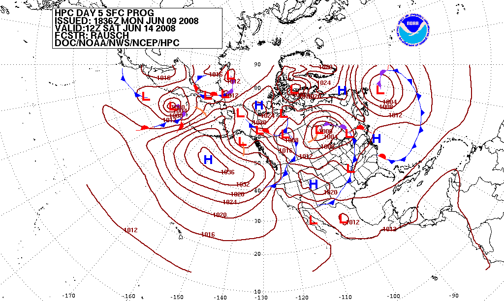
A record-strength El Niño in the tropical Pacific is raising the odds that the UK's stratospheric polar vortex weakens this winter, a shift that can push cold air south, according to NOAA and the Met Office. Forecasters stress this changes probabilities rather than guaranteeing extreme cold, and UK stockpile advice circulating this autumn reflects routine winter preparedness rather than a specific emergency warning.
A record-strength El Niño in the Pacific
The US Climate Prediction Center (CPC), part of NOAA, said on 8 October 2026 that an "El Niño Advisory" was in effect, with the Niño-3.4 index – the standard measure of sea-surface temperature in the central equatorial Pacific – at +2.1°C. The agency said the three-month average could exceed +2.5°C, which would make the event the strongest on record since at least 1950. It put the probability of reaching that historic magnitude at 54% for September–November 2026, 83% for October–December 2026 and 70% for November–January 2027, and said a strong-to-very-strong El Niño had a greater than 83% chance of persisting through January–March 2027.
El Niño is the warm phase of a naturally recurring cycle in the tropical Pacific Ocean. According to LBC, the Met Office's Dr Will Lang described its effect on UK weather as a subtle shift in the odds rather than a certainty, while flagging a heightened chance of wet weather and flooding this season. The Met Office's Professor Adam Scaife said the current event was on course to be unprecedented, having already exceeded previous records with several weeks still to go before its peak, LBC reported.
Unprecedented.
— Professor Adam Scaife, Met Office, quoted by LBC
How a strong El Niño can disturb the polar vortex
The stratospheric polar vortex is a band of strong winds that normally circles the Arctic and traps cold air near the pole. According to an analysis by Karmactive of Met Office outlooks, intense tropical Pacific heating during a strong El Niño can alter North Atlantic jet-stream behaviour, raising the likelihood of Sudden Stratospheric Warming (SSW) events that disrupt this vortex – though it noted the heightened risk applies mainly to the depths of winter rather than early autumn.
When the polar vortex weakens or splits during an SSW event, cold air can spill southward over the UK, LBC reported, citing Met Office analysis. Separately, AOL reported Met Office and BBC Weather forecasters comparing the scenario to the "Beast from the East", the Arctic outbreak that brought prolonged snow and ice to the UK in 2018.
An earlier cold spell illustrates what such disruption can look like on the ground, though not every cold snap is linked to El Niño. A Met Office blog post dated 7 January 2026 recorded -12.5°C at Marham, Norfolk, and snow accumulations of up to 52cm at Oyne, Aberdeenshire, during Storm Goretti. The Met Office attributed that particular spell to clear skies and Arctic air streaming directly from the North Pole, without citing El Niño or a specific SSW event as the cause.
What forecasters are saying about this winter so far
For the near term, AOL reported that Met Office and BBC Weather models pointed to only localised snow – up to 5cm at higher elevations in Scotland around mid-October 2026. The Met Office described the rest of October and early November as likely to follow a changeable pattern overall, with Atlantic low-pressure systems passing close to the UK interspersed by occasional ridges of high pressure. BBC Weather's assessment, as relayed by AOL, found no clear sign yet of a set-up that could lead to an early cold Arctic outbreak, while also noting that a wetter and windier but mild scenario remained possible.
Karmactive's review of the National Energy System Operator's (NESO) winter outlook found grid operators expect an electricity supply buffer of about 5.5 GW, or 8.8% above anticipated demand, indicating no systemic shortfall risk for the season. The same outlet reported that Met Office seasonal guidance pointed to milder, wetter conditions through late autumn, while cautioning against reading such outlooks as a forecast of specific severe events like a polar-vortex-driven freeze.
NOAA probability of a historic-strength El Niño (Niño-3.4 exceeding +2.5°C), issued 8 October 2026
Forecast period
Probability of historic-strength reading
September–November 2026
54%
October–December 2026
83%
November–January 2027
70%
Official guidance: preparedness, not emergency
Alongside the forecasts, LBC reported that the UK government had updated its Prepare campaign toolkit, urging households to keep three days of food in an easily accessible part of the home. British Gas issued parallel winter-readiness advice, the outlet said, including agreeing a family meeting point in case members cannot get home, and sealing gaps around doors and windows and insulating exposed pipes.
Three days of food and drinking water kept in an easily accessible place
Medicine and non-perishable items
Blankets, torches and spare batteries
A family meeting point agreed in advance
Sealed doors and windows, and insulated exposed pipes
Karmactive characterised British Gas's three-day stockpile advice as standard winter preparation rather than a sign the energy grid is at risk, pointing to NESO's projected supply buffer as evidence against infrastructure-failure framing circulating on social media.
Both NOAA and the Met Office frame El Niño's influence on the UK winter in probabilistic terms: it shifts the odds of a weaker polar vortex and more SSW events, without determining any single storm or cold spell. How much of this winter the Pacific pattern actually shapes should become clearer as El Niño approaches its forecast peak toward the end of 2026, per the Climate Prediction Center's latest discussion.
Questions
What is El Niño?
El Niño is the warm phase of a naturally recurring Pacific Ocean cycle, marked by above-average sea-surface temperatures in the central and eastern tropical Pacific. NOAA's Climate Prediction Center said on 8 October 2026 that the Niño-3.4 index had reached +2.1°C, with a possible historic reading above +2.5°C this winter.
Does a strong El Niño guarantee a cold UK winter?
No. According to LBC, the Met Office's Dr Will Lang described El Niño's effect on UK weather as a subtle shift in the odds rather than a certainty, and analysts cited by Karmactive said Met Office outlooks caution against reading seasonal forecasts as predictions of specific severe events.
How is the polar vortex linked to El Niño?
El Niño's tropical Pacific heating can alter jet-stream behaviour in ways that raise the likelihood of Sudden Stratospheric Warming events, which weaken or split the Arctic stratospheric polar vortex and can let cold air spill south over the UK, according to Met Office analysis cited by Karmactive and LBC.
How strong is the 2026 El Niño compared with past events?
NOAA's 8 October 2026 advisory put the Niño-3.4 index at +2.1°C and gave an 83% probability the October–December 2026 average would exceed +2.5°C, which would surpass any El Niño event since at least 1950.
Why are people being told to stockpile supplies this autumn?
The UK government's Prepare campaign and British Gas issued routine winter-readiness guidance — three days of food and water, medicine, blankets, torches and a family meeting point — which LBC and Karmactive described as standard seasonal preparedness rather than a specific emergency signal.
This piece was prepared with artificial intelligence and passed an automated source check before publication. If you see an error, ask for a correction. Request a correction or reply · How we make this
Modern weather forecasts are produced by feeding billions of daily observations into supercomputers that solve physics equations on a global grid, a process called numerical weather prediction. Forecasters then run the model many times with slightly varied starting conditions — an "ensemble" — to gauge how confident a prediction is. Because the atmosphere is chaotic, forecasts lose reliability after roughly 9 to 15 days, according to researchers and national weather agencies.
Brazil's Amazonas state recorded 1,380 forest fire hotspots between October 1 and 10, 2026, a 271% rise from the 372 hotspots counted in the same period of 2025. Governor Roberto Cidade declared a state emergency, and the federal government recognized emergency status in 36 municipalities on October 10, releasing aircraft, firefighters and funds to fight the blazes.
A historically strong El Niño is the dominant signal behind winter 2026-2027, with NOAA's Climate Prediction Center giving it up to an 83% chance of record strength. Forecasters in the US and Europe expect a milder, wetter and stormier season overall, though short cold spells remain possible. Below is what agencies say so far, plus official steps for winterizing a home and car.
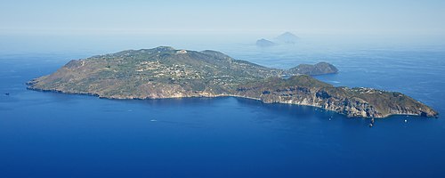
Overnight storms into October 10, 2026 triggered flooding, overflowing streams and landslides across southern Italy, with the worst damage reported on the Sicilian island of Lipari and in Calabria's Reggio area. Italy's Civil Protection Department had issued an orange weather alert for Sicily and parts of Calabria, Puglia and Campania, as mud and debris swept into homes, streets and the sea.