El Niño explained: what is driving the record-strong 2026 Pacific event
Published:
In brief
A naturally occurring warming of the tropical Pacific Ocean, El Niño, has strengthened in 2026 to levels never recorded since instrumental data began in 1950, according to NOAA. Scientists are comparing it to the severe 1997-98 event, but current sea-surface temperature anomalies are already running warmer than that year's peak.
El Niño is a periodic warming of surface waters in the central and eastern tropical Pacific Ocean, driven by a weakening of the trade winds that normally push warm water toward Asia. When those winds relax, warm water sloshes back toward South America, altering atmospheric pressure patterns and shifting rainfall and storm tracks across much of the globe.
Why it is in the news in October 2026
NOAA's Climate Prediction Center said in its ENSO Diagnostic Discussion that El Niño is strengthening, with a greater than 90% chance of a very strong event persisting through the Northern Hemisphere fall and winter of 2026-27. The agency's data show sea-surface temperature anomalies above 3.0°C in the eastern equatorial Pacific, with the Niño-1+2 region measuring +3.4°C, Niño-3 at +2.5°C and Niño-3.4 at +1.8°C as of late August. NOAA puts the odds at 75% that the October-December three-month index will exceed +2.5°C, which would surpass every El Niño on record dating back to 1950.
Climate scientist Daniel Swain said the anomaly, measured on the ONI scale, is far beyond anything previously observed, according to Inside Climate News, which reported the event tied the 1997-98 episode on NOAA's relative ONI (RONI) index by late August before continuing to strengthen through September.
How 2026 compares with 1997
Columbia University's Climate School reported that models from its Center for Climate Systems Research and the International Research Institute for Climate and Society point to tropical Pacific temperatures reaching 3.38°C above average at their November-to-January peak, versus 2.37°C above average during the 1997 event's peak. Climate scientist Muhammad Azhar Ehsan said most of the 22 models used in the forecast reach or exceed 3°C, pointing to an exceptionally strong event, while colleague Andrew Robertson said the certainty behind the forecast was itself unprecedented.
The Hill reported that Ehsan separately noted the atmospheric evolution of trade winds in 2026 closely resembles the pattern observed in 1997, when one of the strongest El Niños on record formed. That event contributed to a chaotic 1997-98 winter in North America: ice storms hit the Northeast while California and the Southeast saw severe flooding, California and North Dakota recorded their wettest winters since 1895, and a January 1998 storm killed 56 people across the U.S. and Canada while leaving millions without power, per The Hill's reporting.
El Niño strength: 2026 forecast vs. 1997-98
Event
Peak Pacific anomaly
Source
1997-98 El Niño
+2.37°C (peak)
Columbia Climate School
2026-27 El Niño (forecast)
+3.38°C forecast peak; +3.0-3.4°C already measured in Niño indices in 2026
Columbia Climate School / NOAA CPC
What the strength could mean
The Climate Impact Lab, a research group that studies climate risks, estimated that the current Super El Niño could be linked to roughly 451,000 additional heat-related deaths worldwide between June 2026 and February 2027, compared with a typical year, with about 239,000 (plus or minus 11,000) of those deaths projected within the first six months. The estimate, built from temperature-mortality relationships across 24,378 regions combined with ECMWF seasonal forecasts, lists Nigeria (31,400), Sudan (17,500) and Niger (10,000) among the countries facing the largest projected tolls, alongside Indonesia, India, Brazil and parts of Southeast Asia.
El Niño is effectively pushing us into the future – exposing us to temperatures that won't be the norm for another two decades.
— Climate Impact Lab researchers
The same research group said proven measures, including heat warnings, cooling centers and targeted health outreach, could prevent tens of thousands of deaths if deployed quickly. Columbia's Climate School separately noted the 1997-98 El Niño was linked to roughly 23,000 deaths and tens of billions of dollars in damage worldwide through crop failures, flooding, fishery collapse and mass coral bleaching.
Regional impacts being forecast
According to Columbia's Climate School, forecasters expect El Niño-linked drought risk to rise across northern South America, Central America, South Africa and Southeast Asia, while above-normal rainfall is expected across the southern United States, lower South America, East Africa, the Middle East and the United Kingdom. Inside Climate News reported that U.S. West Coast impacts could include roughly one additional foot of temporary sea-level rise along the California coast through December, a wetter-than-average winter for Southern California, and a doubled likelihood of coastal flooding during peak tidal periods, prompting advisories from authorities in Los Angeles and Britain.
NOAA's Climate Prediction Center said it will issue its next ENSO diagnostic update on October 8, 2026, and that current forecasts give El Niño conditions close to a 100% chance of persisting through the winter before an expected transition toward neutral conditions in spring 2027.
Questions
What exactly is El Niño?
El Niño is a natural warming of sea-surface temperatures in the central and eastern tropical Pacific Ocean caused by weakened trade winds, which shifts global rainfall and storm patterns, according to NOAA's Climate Prediction Center.
Is the 2026 El Niño really the strongest on record?
NOAA says there is a 75% chance the October-December 2026 index will exceed +2.5°C, which would surpass every El Niño event in the instrumental record dating back to 1950; Columbia Climate School forecasts a peak anomaly of 3.38°C, above the 1997 peak of 2.37°C.
How does 2026 compare to 1997-98?
Columbia scientists say the trade-wind pattern resembles 1997, but current Pacific temperature forecasts are more than 1°C warmer than that year's peak, and NOAA's RONI index already matched 1997-98 as the strongest on record by late August 2026.
How many deaths is the current El Niño linked to?
The Climate Impact Lab estimates roughly 451,000 additional heat-related deaths globally between June 2026 and February 2027 compared with a typical year, concentrated in countries including Nigeria, Sudan, Indonesia, India and Brazil.
When will this El Niño end?
NOAA's Climate Prediction Center forecasts El Niño conditions persisting through winter 2026-27 with near-certain odds, before an expected shift toward neutral ENSO conditions in spring 2027.
This piece was prepared with artificial intelligence and passed an automated source check before publication. If you see an error, ask for a correction. Request a correction or reply · How we make this
Modern weather forecasts are produced by feeding billions of daily observations into supercomputers that solve physics equations on a global grid, a process called numerical weather prediction. Forecasters then run the model many times with slightly varied starting conditions — an "ensemble" — to gauge how confident a prediction is. Because the atmosphere is chaotic, forecasts lose reliability after roughly 9 to 15 days, according to researchers and national weather agencies.
Brazil's Amazonas state recorded 1,380 forest fire hotspots between October 1 and 10, 2026, a 271% rise from the 372 hotspots counted in the same period of 2025. Governor Roberto Cidade declared a state emergency, and the federal government recognized emergency status in 36 municipalities on October 10, releasing aircraft, firefighters and funds to fight the blazes.
A historically strong El Niño is the dominant signal behind winter 2026-2027, with NOAA's Climate Prediction Center giving it up to an 83% chance of record strength. Forecasters in the US and Europe expect a milder, wetter and stormier season overall, though short cold spells remain possible. Below is what agencies say so far, plus official steps for winterizing a home and car.
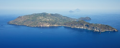
Overnight storms into October 10, 2026 triggered flooding, overflowing streams and landslides across southern Italy, with the worst damage reported on the Sicilian island of Lipari and in Calabria's Reggio area. Italy's Civil Protection Department had issued an orange weather alert for Sicily and parts of Calabria, Puglia and Campania, as mud and debris swept into homes, streets and the sea.