Science · Article
How Scientists Predict Volcanic Eruptions and Warn Communities in Advance
Published:

In brief
Volcanologists forecast eruptions by combining a volcano's geological history with real-time monitoring of earthquakes, ground deformation and gas emissions, then issue tiered alerts that trigger exclusion zones and aviation warnings. Indonesia's Anak Krakatau — whose September 2026 eruption shut Jakarta's main airport for days — illustrates how that monitoring-to-warning chain actually works.
Why this is in the news
Anak Krakatau, the volcanic island that rose in the Sunda Strait between Java and Sumatra after the 1883 Krakatoa eruption, produced a major eruption on Saturday, 6 September 2026, followed by at least three more eruptions on the morning of Tuesday, 8 September, according to Al Jazeera.
The ash blanketed critical airport infrastructure across Java and Sumatra. Five airports, including Jakarta's main Soekarno-Hatta International Airport, closed and then reopened on the Tuesday once crews had cleared ash from runways and facilities, Al Jazeera reported. Indonesia's transport minister, Dudy Purwagandhi, said cargo planes resumed first while passenger aircraft awaited checks.
We will be carrying out inspections to ensure that these aircraft are fit to fly.
Al Jazeera reported the disruption affected more than 340,000 travellers and roughly 2,900 flights. The head of Indonesia's Geology Agency, Lana Saria, said the impact was smaller than previous Anak Krakatau eruptions but that monitoring would continue.
Reading a volcano's warning signs before it erupts
The U.S. Geological Survey's Volcano Hazards Program describes two complementary approaches to forecasting. Long-term assessments catalogue the size, frequency and style of a volcano's past eruptions to establish its baseline hazard. Short-term forecasting then watches for real-time deviations from how that same volcano behaves when it is quiet.
- Seismicity: swarms, frequency changes or shifting locations of small earthquakes can signal magma or fluid moving underground, per USGS.
- Ground deformation: swelling or subsidence as magma accumulates can be detected on the ground and from above, USGS says.
- Gas emissions: changes in the character or rate of gas output point to degassing magma, according to USGS.
- Thermal and satellite imagery: heat anomalies and crater hotspots are also tracked remotely between ground visits, as seen in Anak Krakatau's own monitoring record.
USGS says volcanoes typically give a longer warning phase before an eruption than many other natural hazards. Forecasters use probabilistic 'event trees' — branching diagrams of possible unrest scenarios and their likelihoods — which are updated continuously as new monitoring data arrive, alongside physical and numerical models of how ash, pyroclastic flows or lahars might spread.
Indonesia's four-level alert system in practice
Indonesia's Geology Agency (PVMBG) rates volcanoes on four alert levels, as described by Liputan6: Level I, Normal, covers ordinary fluctuations that do not show increased activity; Level II, Waspada, means initial signs of rising activity have been observed or recorded, with any eruption threatening only the area near the crater; Level III, Siaga, applies when an observable increase in activity or an eruption threatens the area around the crater, without yet threatening settlements; and Level IV, Awas, is used when an observable increase in activity or an eruption threatens settlements around the volcano. Liputan6 notes identical levels can mean different real-world hazards at different volcanoes, and that warnings are issued by the Ministry of Energy and Mineral Resources and conveyed through regional governments.
| Level | Indonesian term | What it indicates, per Liputan6 |
|---|---|---|
| I | Normal | Ordinary fluctuations; no sign of increased activity |
| II | Waspada | First signs of rising volcanic activity observed or recorded |
| III | Siaga | Observable increase or eruption threatening the area near the crater |
| IV | Awas | Observable increase or eruption threatening nearby settlements |
Anak Krakatau's own record shows the system in motion. According to the volcano-monitoring site The Watchers, PVMBG raised the volcano from Level II to Level III on 2 July 2026 at 16:30 local time (09:30 UTC), after an eruption that day sent an ash plume about 200 metres above the summit. In the period from 16 June to 2 July, instruments had logged 740 exhalation earthquakes, 247 low-frequency earthquakes and 520 hybrid or multiphase earthquakes, while satellites picked up rising sulfur dioxide output and thermal anomalies from 1 June and crater hotspots from 10 June, The Watchers reported. Authorities set a 3-kilometre exclusion zone around the active crater.
The Watchers also notes why Anak Krakatau draws extra scrutiny: a flank collapse on 22 December 2018 triggered a tsunami that killed 437 people along the coasts of western Java and southern Sumatra, so eruptions at this particular volcano trigger separate tsunami-hazard checks in addition to the standard ash and ejecta warnings.
Keeping aircraft out of the ash
Ground-based alert levels protect people near a volcano, but ash plumes travel far beyond any exclusion zone. According to Wikipedia, nine regional Volcanic Ash Advisory Centres (VAACs) — in Anchorage, Buenos Aires, Darwin, London, Montreal, Tokyo, Toulouse, Washington and Wellington — divide the world between them and issue advisories whenever an eruption threatens aviation, drawing on satellite imagery, ground and pilot reports, and ash-dispersion models.
Japan's Meteorological Agency, which runs the Tokyo VAAC, describes the process in more detail: forecasters feed wind data from JMA's global weather model into a volcanic ash transport model to project where a plume will be 6, 12 and 18 hours ahead, then issue advisories at least every six hours — normally at 00, 06, 12 and 18 UTC — while ash remains visible on satellite, more often if conditions change quickly. Those advisories reach airlines, aviation authorities and meteorological watch offices, which use them to prepare the flight-planning warnings pilots rely on, JMA says.
That international aviation-warning layer is separate from, but runs alongside, PVMBG's ground alert levels — together they explain why an eruption on a sparsely populated island can still ground hundreds of thousands of travellers at airports hundreds of kilometres away, as happened at Jakarta's Soekarno-Hatta in September 2026.
Questions
- Can scientists predict the exact moment a volcano will erupt?
- Not with precision. USGS says eruptions generally give a longer warning phase than most other natural hazards, and rising seismicity, gas emissions or ground deformation can show unrest building — but monitoring teams work in probabilities and updated scenarios ('event trees'), not fixed eruption times.
- What instruments do volcanologists rely on most?
- USGS points to three main types of change tied to magma movement: shifts in seismicity, ground deformation, and changes in the character or rate of gas emissions, alongside physical and numerical modelling of potential ash, pyroclastic-flow or lahar paths.
- How does Indonesia warn people living near volcanoes?
- PVMBG, the Geology Agency, uses four alert levels — Normal, Waspada, Siaga and Awas — tied to visual and instrumental observations, with warnings issued by the Ministry of Energy and Mineral Resources and passed through regional governments; at Anak Krakatau this included a 3-kilometre exclusion zone when the level was raised to Siaga in July 2026, per The Watchers.
- Why did the September 2026 Anak Krakatau eruption shut Jakarta's main airport?
- Ash from the eruption reached airspace over Java and Sumatra, forcing the closure of five airports including Soekarno-Hatta; Al Jazeera reported about 2,900 flights and more than 340,000 travellers were affected before runways and aircraft were cleared and inspected.
- How do airlines get warned about volcanic ash clouds?
- Nine regional Volcanic Ash Advisory Centres worldwide track plumes with satellite, pilot and model data and issue advisories at least every six hours; Japan's VAAC, for example, forecasts ash position 6, 12 and 18 hours ahead and sends the results to airlines and aviation authorities, according to JMA.
How the world is telling it
- IndonesianIndonesian-language coverage (Liputan6) focuses on explaining PVMBG's four-tier Normal–Waspada–Siaga–Awas system itself, stressing that the same numbered level can mean different real hazards at different volcanoes and urging residents to follow only official Geology Agency guidance — a domestic-safety framing distinct from the flight-disruption angle that dominates international and travel-industry reporting on Anak Krakatau.
Sources
- USGS — Eruption Forecast
- USGS — VHP uses monitoring data and volcanic history to forecast eruptions
- Al Jazeera — Indonesia airports reopen after volcanic ash disrupts thousands of flights
- The Watchers — Anak Krakatau alert raised to Level III after renewed eruptions, Indonesia
- Japan Meteorological Agency — VAAC Operation
- Wikipedia — Volcanic Ash Advisory Center
- Liputan6 — Arti Status Normal, Waspada, Siaga, Awas pada Aktivitas Gunung Berapi
This piece was prepared with artificial intelligence and passed an automated source check before publication. If you see an error, ask for a correction. Request a correction or reply · How we make this
Related
ScienceArticle
Bioluminescence Explained: The Chemistry Behind Light-Producing Organisms
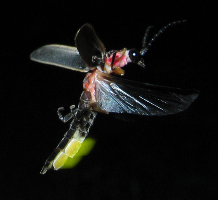
Bioluminescence is light produced inside a living organism by a chemical reaction between a light-emitting molecule called luciferin, an enzyme (usually luciferase) and oxygen. Organisms use this self-made light to find food, attract mates, evade predators and communicate, and it is far more common in the ocean than on land.
ScienceArticle
Five infections linked to 1 in 8 cancers worldwide, new global study finds
An estimated 2.3 million new cancer cases in 2024—about 12% of all cancers diagnosed worldwide—were caused by infections, according to a study from the International Agency for Research on Cancer (IARC) published in The Lancet Oncology. Five pathogens accounted for most of this burden: H. pylori, HPV, hepatitis B, Epstein-Barr virus and hepatitis C. Most of these cancers are preventable through vaccination, screening or treatment of the underlying infection.

ScienceNews
Nobel Prize in Physics 2026 Goes to Francis Halzen for Cosmic Neutrino Discovery
The Royal Swedish Academy of Sciences awarded the 2026 Nobel Prize in Physics to Francis Halzen on October 6 for his decisive role in building the IceCube Neutrino Observatory and discovering high-energy neutrinos of astrophysical origin. Halzen, a University of Wisconsin–Madison physicist, conceived the idea of using Antarctic ice to detect these cosmic particles.
ScienceArticle
How Learning Works: What Neuroscience Says About Memory and the Brain
Learning happens when repeated neural activity strengthens connections between neurons, a process called long-term potentiation. Sleep later helps lock those new connections in, and research on study methods shows that spaced, active recall produces far more durable memories than rereading or cramming.